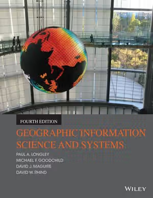
01 / Reading Guide
Reading Guide
Citation
Longley, P. A., Goodchild, M. F., Maguire, D. J., & Rhind, D. W. (2015). Geographic Information Science and Systems (4th ed.). Wiley.
Chapter Summary
The fourth edition runs to 496 pages and 19 chapters. An opening chapter introduces the field, and the remaining chapters fall into four parts: Principles (Chapters 2–5), Techniques (Chapters 6–10), Analysis (Chapters 11–15) and Policy, Management, and Action (Chapters 16–19). Wiley says the book pairs the scientific principles behind GIS use with up-to-date coverage of procedures, techniques and public-policy applications, and that a subtle change to the title of this edition reflects the evolution of the science of problem solving with geographic information technologies. Every chapter ends with Questions for Further Study and Further Reading.
Chapter 1: Geographic Information: Science, Systems, and Society
The introduction explains why location matters and why "spatial is special", separates data, information, evidence, knowledge and wisdom, and looks at the field from historical, business, government, computer-science, geography and societal perspectives.
Part 1, Chapters 2–5: The Nature of Geographic Data; Representing Geography; Georeferencing; Uncertainty
The Principles part begins with the properties that make geographic data distinctive: spatial autocorrelation, scale, sampling, distance decay. It continues with digital representation (discrete objects and continuous fields, rasters and vectors, generalization), georeferencing (place names, addresses, latitude and longitude, projections, GPS) and a full chapter on uncertainty in conception, representation and analysis.
Part 2, Chapters 6–10: GI System Software; Geographic Data Modeling; Data Collection; Creating and Maintaining Geographic Databases; The GeoWeb
The Techniques part covers the technology: software architecture and types of systems (desktop, web, server, mobile), raster, vector and object data models, data capture and transfer, database design with SQL and topology, and distribution through geoportals, mobile services and web services.
Part 3, Chapters 11–15: Cartography and Map Production; Geovisualization; Spatial Data Analysis; Spatial Analysis and Inference; Spatial Modeling with GI Systems
The Analysis part turns to making and analysing results: map design and symbolization; cartograms, dasymetric maps and participatory and 3-D visualization; analysis by location (overlay, spatial joins) and by distance (buffering, interpolation); area, centrality, surfaces and routing with hypothesis testing; and spatial models including cellular models and map algebra.
Part 4, Chapters 16–19: Managing GI Systems; Information and Decision Making; Navigating the Risks; Epilog: GISS in the Service of Humanity
The final part addresses organisations and society: risk and return on investment, information as infrastructure and open data, legal, privacy and ethical constraints with spatial data infrastructures, and a closing chapter on citizen science and global challenges such as population, health, disasters and sustainability.
Key Concepts
Chapters 1–5: Principles
- Spatial autocorrelation and scale: nearby places tend to be alike, and findings change with the scale of analysis.
- Discrete objects and continuous fields: the two ways of conceiving geographic phenomena that underlie raster and vector data.
- Georeferencing and projections: methods of attaching coordinates to places and flattening the Earth's surface.
- Uncertainty: treated in three stages, in conception, representation and analysis.
Chapters 6–15: Techniques and Analysis
- Data models: raster, vector and object representations and their use in databases.
- Geovisualization: interactive and participatory display of spatial data.
- Spatial analysis: overlay, buffering, interpolation and inference from geographic data.
- Map algebra and cellular models: approaches to spatial modeling in Chapter 15.
Chapters 16–19: Policy, Management, and Action
- Open data and spatial data infrastructures: sharing geographic information among organisations and countries.
- Citizen science and the active citizen: the Epilog's picture of non-specialists contributing to GI projects.
Critical Analysis
Strengths
- Science, technology and society together. The four-part structure treats principles before software, and analysis before management, so the technology is introduced after the ideas that justify it.
- A dedicated chapter on uncertainty. Chapter 5 devotes a full chapter of the Principles part to uncertainty in the conception, representation and analysis of geographic phenomena.
- Recent developments. Wiley's list of changes for this edition includes big data and open data, data science, mobile computing and citizen-centred science, open software, computationally intensive methods and the role of GI in addressing global challenges.
- Learning supports. Wiley notes learning objectives and review boxes throughout each chapter, and the contents show Questions for Further Study and Further Reading at the end of every chapter; instructor materials include slides and a manual.
Limitations
- Not a software tutorial. The book is organised around concepts rather than a particular package; Chapter 6 surveys software types and vendors, so hands-on practice in a GIS package has to come from elsewhere.
- Dated in places. Published in 2015, the book's vendor survey (Autodesk, Bentley, Esri, Intergraph) and its treatment of web and mobile technology reflect that time.
- Length and range. Nineteen chapters and 496 pages cover principles, technology, analysis and management; a one-term course will select among the parts, and Part 4 is oriented to organisational and policy readers.
- Limited space for statistics. Spatial analysis and inference occupy Chapters 13 and 14, about fifty pages by the contents list, so students who need statistical depth need a specialist text.
Where It Fits in the Course
Longley and colleagues' book is the broad, principles-first textbook in this course. Bolstad's Geographic Information Systems Fundamentals is described as a comprehensive introduction to GIS theory and practice, covering the development, management, analysis and cartographic visualization of spatial data, and is the other general GIS text on the list; either could serve as a main text. Longley and colleagues give a whole part to management, policy and society, which Bolstad's description does not emphasise.
For depth in specific areas, O'Sullivan and Unwin's Geographic Information Analysis is a textbook on the statistical methods behind GIS and gives a deeper treatment of the topics of Chapters 13–14. Krygier and Wood's Making Maps is a heavily illustrated design guide for people who make maps with GIS software and is the practical counterpart to Chapter 11. Monmonier's How to Lie with Maps is a short introduction to how maps simplify and distort, and Harley's The New Nature of Maps collects essays on maps as cultural documents, both useful companions to the representation chapters.
How to Use This Book
Wiley describes the book as a best-seller across a broad spectrum of disciplines. Chapter 1 introduces the field from the beginning, so no prior GIS experience appears to be assumed; basic familiarity with maps and computers helps.
A practical plan: read Chapter 1 and the whole Principles part (Chapters 2–5) first, since later technical chapters assume the ideas of representation, georeferencing and uncertainty. Take Chapters 7 (data modeling), 9 (databases) and 13–14 (analysis) as the core of a technical course, and use Chapters 6, 8 and 10 to understand software, data capture and web delivery. Chapters 11–12 suit a mapping emphasis. Chapters 16–19 are the natural reading for management, policy or applied courses.
Work through the Questions for Further Study, the learning objectives and the review boxes in each chapter, and combine reading with a GIS package and real datasets so that the concepts of Part 1 are met in practice.